In the March newsletter:
2025 Feral animal tally results, a new staff member er for NSPNR, project updates and more.
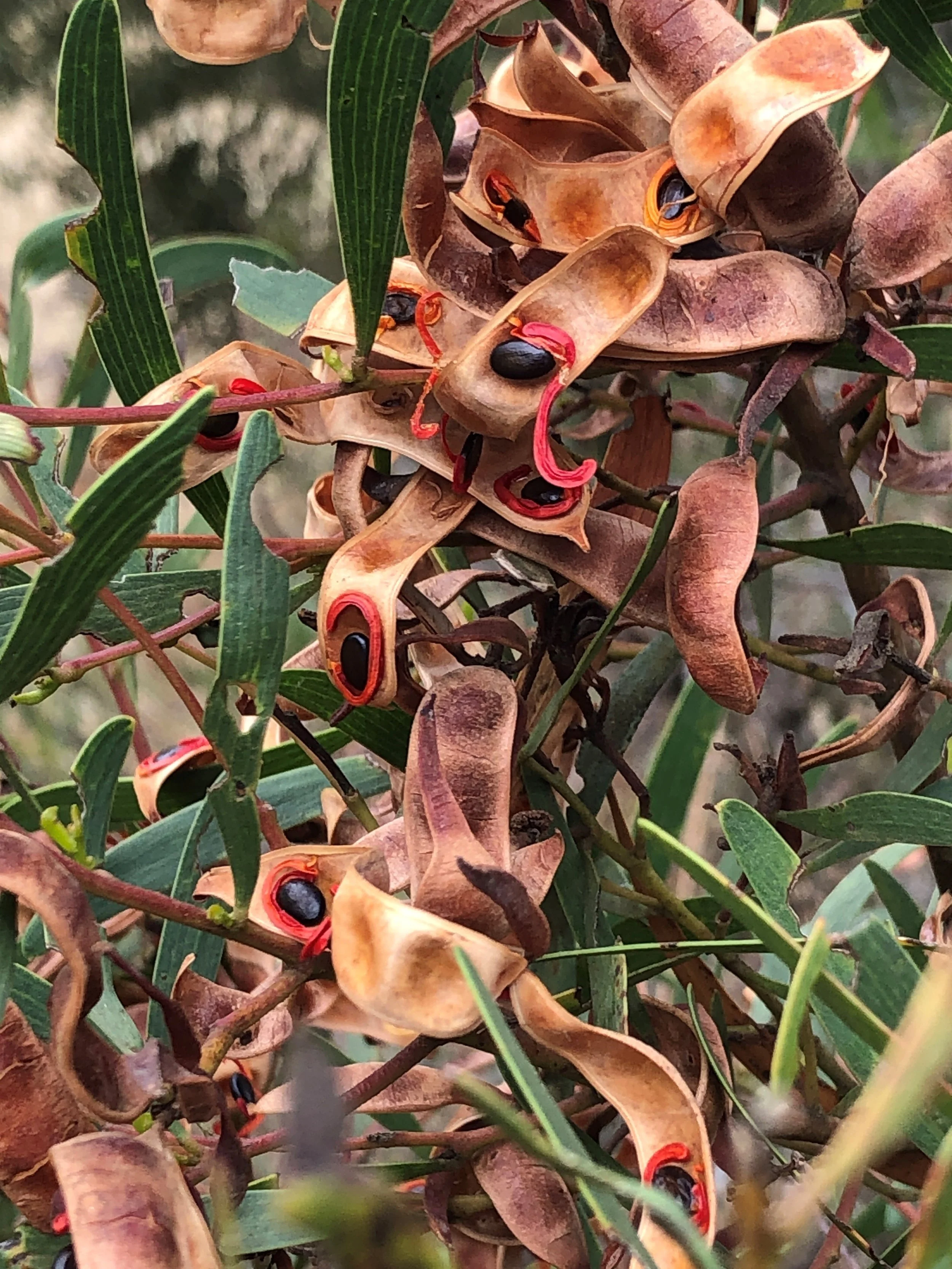
Another successful year of the NSPNR-Yongergnow Feral Animal Tally! We had 7 legendary teams across the North Stirlings Pallinup region who together took out 109 foxes, 12 cats & 19 rabbits! Yongergnow Café put on an incredible feed for the Ongerup Tally go-ers and the Ongerup Community members. Attendees heard from project officer Laura Page about the project and why pest control is so important for protecting some of our incredible native species such as the Malleefowl! Licensed Pest Management Technician (LPMT) Greg Elliott spoke to the crowd about some of the work he has been doing implementing pest control on farms including fox/cat baiting and various rabbit control methods. In Gnowangerup at the CRC, Tara McDonald catered a wonderful breakfast for the teams and community members.
Huge thankyou to The Shire of Gnowangerup for their assistance at the tips with the Tally and our generous sponsors – Ongerup Farm Supplies, Summit Fertilizers, Farmers Centre Albany, Gnowangerup Hardware, Stirling Steelworks & WAMMCO.
CONGRATULATIONS TO THE WINNING TEAMS:
Overall First Prize (points) $100 - North Stirlings Downs
Overall Second Prize (points) $700 - Corackerup Killers
Overall Third Prize (points) $500 - Safety Off
Heaviest Cat - ONGERUP $150 - Corackerup Killers
Heaviest Cat - GNOWANGERUP $150 - No Recoil
First Place - ONGERUP 5x $20 Yongergnow Café Vouchers - Corackerup Killers
First Place - GNOWANGERUP 5x $20 Little Grove Café Vouchers - North Stirlings Downs
This project is funded by the Australian Government under the Saving Native Species Program and South Coast Natural Resource Management as a member of the Commonwealth Regional Delivery Partners panel, and is delivered by North Stirlings Pallinup Natural Resources (NSPNR)

NSPNR has been successful in obtaining full funding of $445,519 for our recent Community Stewardship Grant - large application ‘Classroom to Paddock: Enriching NSP Culture and Biodiversity’
The Classroom to Paddock Project promotes cultural connections and environmental stewardship among the three local schools and landholders in the North Stirlings Pallinup sub-region of WA. The project maintains momentum of current State NRM projects, a gap in funding would be detrimental to progress:
1) Capitalising on landholder’s increased willingness to participate in collaborative revegetation and protective fencing projects: - Addressing ecological damage from land clearing - Improving soils, waterways, threatened species habitat & corridors with high quality native revegetation
2) Fostering Gnowangerup Aboriginal Corporation partnership: - Sharing cultural knowledge - Seed collection services
3) Immersive school programs encouraging environmental and cultural awareness.
This project will run January 2025 - December 2027
NSPNR thanks State NRM for supporting this project
The project, NSPNR Looking Back to Plan the Future, aims to improve strategic planning and evidence-based decision-making by North Stirlings Pallinup Natural Resources Inc by reviewing the organisation’s past projects to enhance the accessibility and usability of natural resource data. After digitization and consolidation of paper records and dispersed mapping files, a 20-year analysis of past projects will then be undertaken to inform strategic planning. This initiative will increase conservation impact by enabling better monitoring and management of natural resources, leading to more effective conservation strategies and outcomes. The project's success will be measured by enhanced accessibility to project data and a prioritized list of future activities.
The project will run January 2025 - February 2026.
NSPNR thanks State NRM for their support of the project.
NSPNR welcomes Ciara Nalty to the role of Chair.
Ciara can be contacted on mob. 0450 102 344 or cmnalty@gmail.com

Ciara Nalty (right) pictured with her partner Brandon Wise at the NSPNR 2024 Annual General Meeting
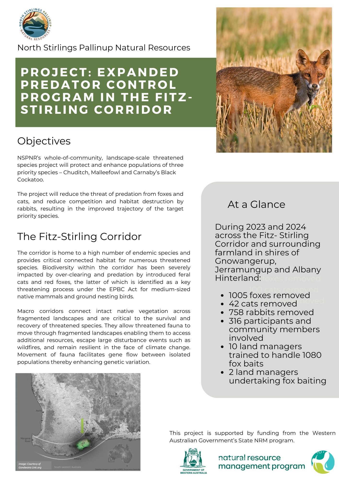
North Stirlings Pallinup Natural Resources Inc (NSPNR) is wrapping up the Expanded predator control program in the Fitz-Stirling Corridor project. This project aimed to protect and enhance populations of three important species – Chuditch, Malleefowl and Carnaby’s Black Cockatoo –across the Fitz-Stirling macro corridor and surrounding farmland
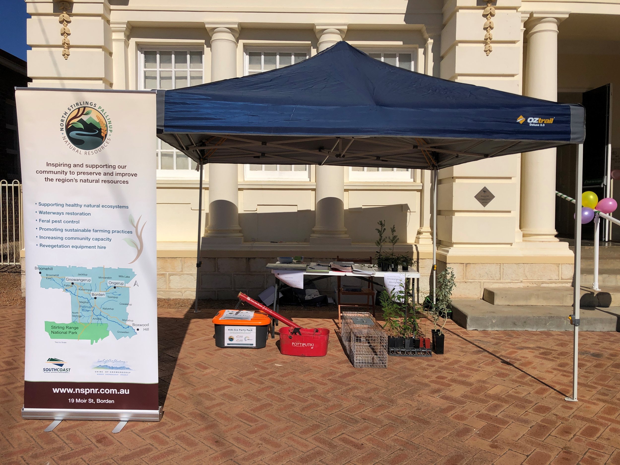
NSPNR was pleased to take part in the celebrations marking the Gnowangerup Town Hall’s centenary at the Heritage Hall Fair on Sunday, 14th April. We were delighted to be involved and to showcase NSPNR’s mission of ‘promoting healthy and productive landscapes that support prosperous communities and businesses across our catchment area’ and we commend the organisers on a great community event.
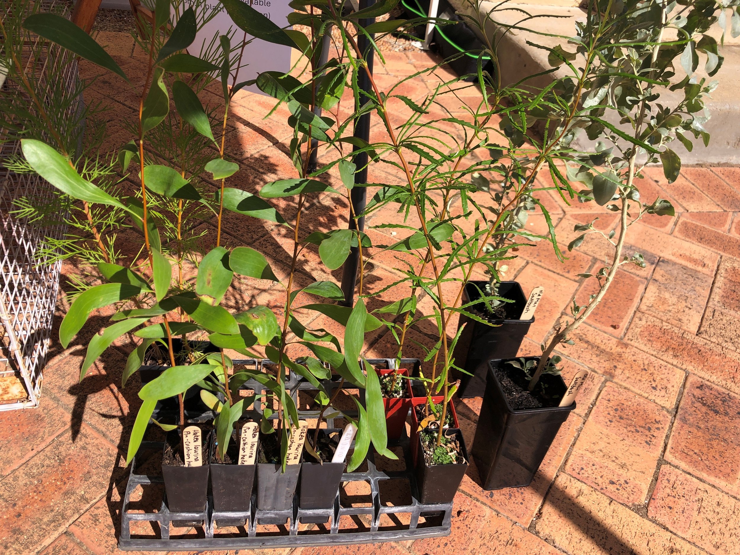
At our stall, our project officer Laura Page displayed NSPNR’s cat trap, Eco Kids Party Pack, a pottiputki, a kidney basket, and various publications, including the NSPNR native planting guide and a flyer about our Expanded predator control program in the Fitz-Stirling Corridor project . We also exhibited a variety of native plants from the Gnowangerup Aboriginal Corporation’s nursery, such as pincushion hakeas, brown’s banksia, sweet hakea, and old man saltbush.
We received queries on topics including quondong trees, invasive species, protective vegetation fencing, tree planting, re-vegetation, and fox baiting, among other interesting subjects from members and local residents. We were pleased to welcome new members, particularly from the western area of our catchment, who joined both our organisation and our new WhatsApp group.
A big thank you to Laura for representing NSPNR, and for comittee members Bec and Peter for adding support.
Dan recently completed a Masters of Ag Science at UWA, during which he did research on the impact of land use on soil carbon content and stability up to the depth of 1m on a Wheatbelt farm (the UWA farm in Ridgefield). Dan reached out to us to share his research and we here at NSPNR thought it was very topical and wanted to share! We hope you find Dan’s summary of his project interesting.
Unearthing the impact of land use on deep soil carbon: a West Australian Wheatbelt example
Dan Kierath
Key Points
· Land management decisions can impact carbon content and stability in soil.
· Soil carbon stability increases with depth and soil clay content.
· Any decision to increase soil carbon is subject to farm-level meteorological, soil and financial constraints.
The topic of atmospheric carbon and its impacts can be highly contentious and promote strong reactions from both sides of the debate. But one point that cannot be argued is that all of Australia’s big four banks and Rabobank are all signatories to the Net Zero Banking alliance, which is a global banking agreement to have a lending portfolio with net zero emissions by 2050. This means that a farm’s carbon footprint may become a factor impacting access to, or the interest rates of, debt finance.
There is no silver bullet to reduce farm emissions, and this will require an industry-wide effort to achieve. One proposed method to mitigate farm emissions is changing the management practices to increase carbon storage in soil, which can have the additional benefit of improving soil health. Increasing soil carbon has a large sequestration potential globally but is highly dependent on local conditions and this research investigated the impacts of management decisions at the UWA farm in Pingelly, which has sandy and loamy duplex soils.
The content and stability of soil carbon were measured at 4 depth intervals to a depth of 100cm from paddocks with 4 land uses; annual grazing, perennial grazing, forage shrub (Mallee Saltbush) and Salinity Revegetation (Golden Wattle with grass interrow). The aim was to also include soil samples from a cropping paddock, but they had to be excluded due to issues with sample collection methodology.
The soil samples were analysed for organic carbon content and were incubated for 26 days to measure how stable the soil carbon is to microbial decomposition, with some of the key results shown in the figures below.
Figure 1 shows the soil Total Organic Carbon (TOC) content for each of the land uses, across the 4 depths (Depth 1 is 0-10cm, 2 is 10-30cm, 3 is 30-60cm and 4 is 60-100cm). As can be seen, the carbon content in the soil can be impacted by the management practices that occur on top of it. Furthermore, the content decreases as depth increases.
Figure 2 shows the stability of the soil carbon by sample depth and by land use. The higher up the y axis a data point is, the larger proportion of the carbon in the soil that was converted to CO2 by the soil microbes. Figure 2a shows that carbon in the shallower soil samples was less stable than deeper soil carbon, whilst Figure 2b shows that the soil carbon in the perennial grazing soil samples was the most resistant to microbial decomposition and the carbon in the salinity revegetation was the least resistant. Additionally, soil particle size analysis of the soil showed that carbon stability increases with higher clay content.
So how is this useful to you? Although the results would likely differ if the same research was conducted in the North Stirling Pallingup region, this research shows that farm-level decisions can impact soil carbon content and stability. This research does not necessarily support large scale farm management changes, rather it may inform the scale of opportunity available with soil carbon, which is only one part of a farm business’ carbon footprint. Increasing soil carbon may not be the most cost-effective method of decreasing a farm business’ emissions profile and for some, improvements to nitrogen use efficiency or flock genetics may be cheaper and have a larger impact and should be prioritised. The difficulty and impact of any decisions will vary for each farm business and should be made with input from farm advisers, considering to each farm’s production and financial factors.

Figure 1: Comparisons of the distribution of Total Organic Carbon by Land Use, by sample horizon. Length of error bars is equal to 1 standard deviation.

Figure 2: Comparison of CO2 respiration (mg CO2 per g of sample soil carbon) of TOC by time and depth (left), TOC by time and land use (right). The higher the value on the y-axis, the more of the soil carbon was respired by the soil microbes and converted to CO2.
I would like to thank GGA and WALRC for their support in this research.
This research was completed wholly as part of my Masters of Ag Science at UWA and is not associated in any way to my employment at Select Carbon.
North Stirlings Pallinup Natural Resources has challenged Fitzgerald Biosphere Group to see whose teams can shoot the most foxes. The events are supported by NSPNR’s project, Expanded predator control program in the Fitz-Stirling Corridor that aims to reduce the number of feral cats, foxes and rabbits in the area.
This website has been updated with the support by funding from the WA Government’s State NRM Program, supported by Royalties for Regions.